
Purchase
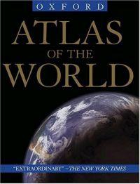
A large-sized volume of color maps of the various regions of the world, countries, islands, and the continents. Includes several removable paper fold-out maps and an index of countries for easy referencing.
12th Edition
Oxford University Press
October 2004
304 pages
ISBN: 0195221478
Hardcover (reprint)
Add to Wish List
Non-Fiction
Eleven years ago, the first edition of Oxford's Atlas of
the World was met with praise for the incredible beauty
and accuracy of its maps as well as for its wealth of
geographic data, and each successive edition only collects
more accolades. The New York Times Book Review
called it a "veritable encyclopedia of geographic and
demographic information, profusely illustrated with
multicolored maps and graphs," and the Baltimore Sun
exclaimed that the newest edition was nothing less than "a
magnificently produced example of quality publishing." Replete with 67 maps of cities worldwide, the 12th edition
charts the key urban centers of each continent from Athens,
Greece (including its new airport) to Wellington, New
Zealand. As in past editions, the Atlas has been completely
updated to reflect the changing world around us. Refined
name forms in Malaysia and South Africa, the addition of a
new state in Indonesia, extra name detail in the Atlantic
and the Pacific Oceans and dozens of other improvements
make this the most reliable atlas on the market. The unique Gazetteer of Countries adds a yet another quick
reference tool to a book already teeming with useful
information. Several new features further enhance the 12th
edition. Interstate and state highways are now shown
throughout North America, putting the overall precision and
clarity of the book well ahead of the competition. A Glossary of Geographical Terms will be an enormous asset
to those unfamiliar with foreign terminology while the
colorful Introduction to World Geography--redesigned and
beautifully illustrated with tables and graphs--provides
informative summaries of topics as diverse as climate,
global warming, plate tectonics, international conflicts,
agriculture, trade, and population. What's more, detailed
explanatory captions accompany the section of full-page
satellite images that Library Journal
called "stunning." Offering the finest global coverage available, the Atlas
of the World sets the standard in atlas quality, living
up to its reputation as an "indispensable reference,"
granted by NBC's Weekend Today Show.
Comments
No comments posted.
Registered users may leave comments.
Log in or register now!
| 


 © 2003-2025 off-the-edge.net
all rights reserved Privacy Policy